Find answers to all of your National Burial Grounds Survey queries below.
|
FAQS
Answering all your NBGS questions
Here you will find a breakdown of freqeuntly asked questions about the National Burial Grounds Survey, from an overview of the benefits to details on logistics for consideration.
Use the search bar or scroll below to find an answer.
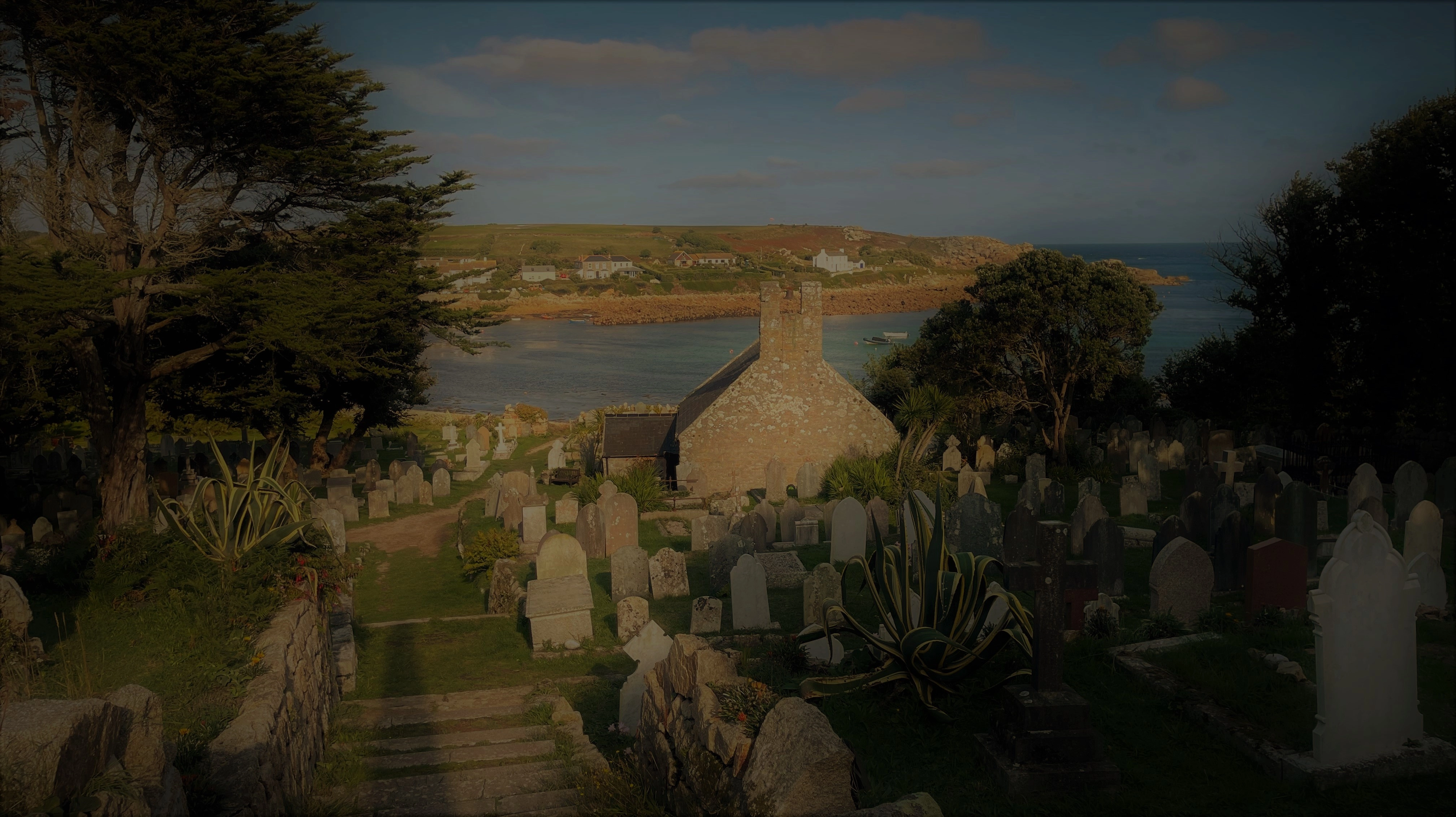
The National Burial Grounds Survey (NBGS) is a seven-year project to survey and accurately map all Church of England (CoE) churchyards, in England, diocese by diocese, churchyard by churchyard. Churches of other denominations and cemeteries are excluded from the project, even if they are attached to CoE premises.
This is the first time a project such as this has been done anywhere in the world.
The Cathedral and Church Buildings Division of the Church of England has mapped the location of all their churchyards (including extensions and other burial grounds), which can be viewed on the Church Heritage Record. The NBGS is the next phase and aims to record every square inch of every churchyard in England, photograph all the visible memorials and scan and transcribe all the parish registers before collating all of the information onto a digital, interactive map. All the information will be in one place and of a consistent standard and quality. As well as then knowing the extent of all the churchyards, exactly where they are and where the features within them are located, valuable historic records will have been preserved.
Photographs of all the fixed memorials (excepting very recent or sensitive examples), some of which may deteriorate over the next few years, fall down or be laid flat, will provide a comprehensive catalogue.
The NBGS will:
• provide parishes with a highly efficient tool to help manage their churchyards and maintain their burial records
• ensure all records and information will be of a consistent standard across the Church of England
• provide a detailed, up-to-date and accurate on-screen churchyard map showing the location of each memorial, the footprint of the main church building and other details such as trees, paths, buildings and benches
• help parishes manage future burials and provide confidence about the reservation of grave spaces
• help visitors to find their relatives' graves
• provide information for faculty applications and churchyard management plans
• enable measurements of distance and area
• mean parish registers are backed up safely and securely
• help with management of the biodiversity of churchyards
• become a tremendous asset to schools, education and research.
Nothing. The project is being undertaken at no cost to the Church of England or their parishes.
Each church will be visited four times to complete the project:
1. To survey the churchyard and main church building
2. To photograph fixed memorials
3. To collect any registers held at the church for scanning
4. To return any registers held at the church, following scanning.
In preparation each church will be asked to:
• give permission for access to the churchyard and main church building, for the purpose of mapping and photographing memorials (this permission will be sought separately for external and internal areas)
• give permission for registers to be collected, digitised and returned; and provide any relevant registers held at the church for digitisation on a specified collection day
• tidy the church grounds to the best of their ability by cutting the grass or sweeping leaves prior to surveying and/or photography; anything hidden cannot be mapped or photographed
• be available on specified visiting days to provide access to the church interior, where permission has been given, unless your church is open publicly anyway.
We understand that some churches may have wild areas which are unable to be cut at certain times of year. We will do our best to work with you in these scenarios to have the least impact on your churchyard’s biodiversity.
Churchyards are the perfect places for lichen species to flourish. You should not remove lichen from any memorials. Our Memorial Photographers will do their best to capture a high-quality image regardless.
Each diocese will sign a Memorandum of Understanding, advocating for their parishes to take part in the project. Each parish within the diocese will then be contacted to ‘activate’ the project in their parish, by providing individual permission to access the church registers and external/internal areas of the church for the purpose of surveying and memorial photography. To check if your church have signed up, you can contact your PCC, or email bgms@agintl.org.
The project will start in the Autumn of 2021. It is expected to take seven years to complete. There may be some time between your diocese agreeing to take part in the project and work taking place at your church. AG Intl Ltd will keep you informed of progress during this time.
The Archbishops’ Council of the Church of England have signed an agreement with AG Intl Ltd (known as ‘AG’, formerly Atlantic Geomatics), a geospatial consultancy based in Cumbria. AG will manage the project and carry out the survey and mapping, the memorial photography and arrange for the scanning and indexing of the parish records directly.
AG Intl Ltd (known as ‘AG’, formerly Atlantic Geomatics) is a Cumbrian geospatial consultancy with experience in general land, building and utility surveying. AG have already mapped hundreds of churchyards and cemeteries across England and developed an online, high quality and easy to use website product: the Burial Ground Management System (BGMS), via which the results of the project will be displayed. The BGMS is a bespoke, comprehensive, innovative solution designed and created specifically for the mapping of churchyards and interaction with associated registers and records.
AG is funding the project in total. AG will coordinate and manage the project, people and equipment and be the point of contact for communications. AG will manage and fund all the surveying, mapping, memorial photography, record digitisation, indexing and technical product development.
The resulting maps will be linked to the Church Heritage Record to form a national database for the Church of England, thereby creating a common digital record throughout the church estate. AG are also working with Caring for God’s Acre (CfGA) and will be providing tools in the BGMS to record biodiversity in churchyards.
Initial contact to churches will be received from the diocese. AG will then be in touch with practical details. AG aims to give around 2 weeks’ notice of any visit to each church. This will be via the person who’s contact details have been provided in the initial stages of the project only. Please note AG will only keep in touch with those for whom contact details have been given.
Yes. Churches without a burial ground may still have registers of baptisms or marriages, which are included in the project. Their church building and any surroundings may also be included in a survey to create a map. Where internal access permissions have been granted, the interior of all churches will be scanned, regardless of whether there is an external burial ground attached to the building.
Yes, where a church is closed, elements of the project may still be able to go ahead. For example, the registers of all churches are included within the project, as long as the parish gives permission for them to be accessed. Where a church has closed and is no longer managed, consent will be sought from the PCC and/or incumbent whose parish the church is within.
If a churchyard is maintained by a local authority or parish or town council, AG will be in contact with the relevant organisation to advise of the project. Consent from the church is still required to proceed and the church may liaise with their maintenance partners for practical details.
It will take about 10 months, on average, to complete a whole diocese. Large dioceses may take longer than this, and smaller diocese may be completed sooner. AG will keep you informed throughout.
AG will give around 2 weeks’ notice of the intended survey date. Upon arrival the surveyor(s) will walk the churchyard to assess the best survey route. The duration of the survey will depend on the size of the site, but an average churchyard will take around 1 to 2 hours to complete. Please note the survey is weather dependent and surveyors must be able to move about uninterrupted during the survey. The survey will be undertaken using laser scanners, mounted on either a backpack or handheld scanning device. The survey is not intrusive and no ground works will be undertaken at any site.
A new survey will be done of each churchyard. The completed map will include visible features within the curtilage – fixed memorials and headstones, vegetation such as trees, paths and roads, buildings, lychgates, signs and benches. A survey of the interior of the main church building will also be carried out, where internal access permission has been granted; the map will show key features such as main pillars and window locations.
All visible, fixed memorials in each churchyard will be surveyed, mapped and photographed including plaques for cremated remains. Memorials will be categorised (e.g. cross, plaque, chest tomb). Where usually-fixed memorials have been moved (e.g. headstones laid to the side of a churchyard), these will be mapped in situ. If access has been granted to the interior of the Church, any fixed memorials on the walls inside the main church building will also be mapped.
The surveying technology allows AG to map what can be seen only. As such, unmarked graves will not be mapped. However, unmarked graves can be added by the church in the future should evidence of their location become available.
Any moveable objects, unfixed memorials and small trees, bushes and shrubs will not be mapped. In compliance with UK GDPR, memorials and data of a recent nature will only be available to authorised PCC members and will not become publicly available. Any area which is unreachable on foot during surveying and/or memorial photography may also be omitted.
A survey of the interior of the main church building will accurately record its size and shape. It is cost effective to do this at the same time as mapping the rest of the churchyard. AG will store the scan data and if/when requested to do so will be able to provide drawings, plans and measurements of the interior of the main church building. A fee will be charged for drawings and plans without the additional cost of a return to the site. The fee will depend on the size and detail in the church and what information is required on the drawing. AG will be pleased to discuss each case with the appropriate church or parish.
After the survey has been carried out and the map has been created, AG will return to the church to take photographs of the mapped memorials, both externally and internally where permissions have been granted. AG will advise each church of this date and aim to give around 2 weeks’ notice. Where a memorial has inscriptions on more than one side, multiple photographs will be taken.
Each photograph is saved in the BGMS and linked to the appropriate mapped memorial. Photographs of memorials which AG have been requested to withhold will not be published. If you would like to request that an individual memorial is excluded from the map, please ask your PCC to contact AG with details.
Through scanning, records will be preserved and stored digitally to a consistent standard. Information will be easily accessible and the risk of damage and/or loss of records by fire, theft or flood will be mitigated. Viewing records online will prevent the need to unnecessarily handle and possibly damage these valuable documents.
All registers fall under the responsibility of their owner: the individual PCC. This is why consent is required from the PCC to digitise the records.
Each record in each register will be transcribed (indexed) and input into the BGMS database. The names in the index will then be matched to the relevant photographed memorial(s) using it’s inscription (where legible). For closed churchyards, the records will be linked to a general location for the site of the former church.
Unfortunately, the inscription of some memorials will have deteriorated making the matching impossible. Records of persons interred which cannot be matched will be associated to the church site and recorded as ‘Unknown Location’ within that churchyard. Each church may have other records to assist in making these links, for example paper grave plans. The tools to make these links will be available in the BGMS for the church to make themselves upon publication.
When everything has been completed in a diocese, AG will:
• provide free and secure access to each PCC for their map(s), memorial photographs, register data and images
• provide authorised church representatives with the tools to maintain and update their map(s) and records
• provide a free, read only version of the map to the public; this secure version will display only the map, memorial photographs and UK GDPR-compliant register data and will have very limited functionality compared to the PCC-version.
As well as the complete survey, mapping, memorial photographs and register scanning/indexing, each parish will have free, secure access to the map of their own churchyard(s) where they will be able to click on a memorial to see who is interred and view a photograph of the memorial (if there is one and where it was fixed and legible).
Authorised church representatives will also be able to view all records and carry out searches by name, age and burial date. Tools will be available for a chosen, named representative to add new burial, baptism, marriage and cremated remains interment records (where applicable), add new memorials and associated photographs, record reservations, enter full memorial inscriptions and record biodiversity. A user guide and support will be available upon publication.
Members of the public will be able to view a map of each churchyard. This will be free of charge and read only displaying only the map, memorial photographs and UK GDPR-compliant register data with very limited functionality compared to the PCC-version. The public will be able to carry out a simple search by name of UK GDPR-compliant records, see where in the churchyard a person is interred (if known), view photographs of memorials and view images of registers. To conduct detailed searches and access complete details the public will be required to pay a fee or subscription.
A complete, catalogued set of the scanned parish register images will be given to the diocese for safe keeping and curated by the Archbishops Council, so they are completely safe in perpetuity. They are for internal reference only and cannot be used for commercial purposes.
• input new baptism, marriage, burial and cremated remains interment records – viewing and editing of these records will be restricted to only those with password access and will meet UK GDPR regulations
• add new memorials
• add new photographs (e.g. of new memorials or when an inscription is changed) or historic images
• record memorial inscriptions
• record grave numbers against memorials
• access advanced search facilities
• record bio-diversity - tree species, flora and fauna – with support from Caring for Gods Acre
• take measurements (distances and areas)
• record feature attributes e.g. memorial materials, tree preservation orders
• add reservations and available spaces
• link burials to unmarked locations e.g. where a memorial does not exist
• access online training and user guides
• access system updates and improvements
• access an exclusive and secure web portal for customers with news, updates and much more
An in-depth user guide is available within the system. Technical client support is available by phone and email.
To access the functionality listed above in 6.5, no subscription is required. For advanced functionality, subscription fees of £8.00 per month (plus VAT) for each individual church will enable the following additional functionality:
• recording of health & safety inspections of memorials
• creating and downloading customised drawings of the churchyard e.g. for a faculty application
• adding grave/burial plots
Such subscriptions will be fixed for a minimum of five years from the start date. Any subsequent increase will be based upon the five year inflation figures. Subscriptions can be taken out at any time in the future. Subscriptions can be paid monthly. Subscriptions must be taken out for a minimum of three years.
AG will visit ALL churchyards previously privately surveyed by AG to repeat or complete any remaining activities and bring the system in line with the rest of the project at no cost. There will be no future subscription payable. Checks will be put in place to ensure that all photos and transcribed records meet the overall standards of the project.
AG will own the data it creates, including the digital images and indexes of the parish records, the map of each churchyard/building and the photographs of the memorials. The Archbishops’ Council recognise AG will retain the right to market the data to the public and recover their investment.
The NBGS will be carried out in accordance with UK GDPR. Baptism records less than 90 years and marriage records less than 70 years will NOT be added to the public version of the BGMS and will NOT be published publicly. A proportion of memorials may contain information which relates to identifiable living individuals. The processing of all memorial photographs will be subject to UK GDPR. Photographs of memorials which AG have been requested to withhold will not be published.
AG Intl Ltd will create a separate account on the BGMS in the name of the Archbishops’ Council to which the Council will have access in the event of any form of insolvency process, any situation where AG is in material breach of any obligation to a church entity, or any situation where AG ceases to provide the services.
All users of the BGMS will have access to a portfolio of online training tutorials and user guides.
Memorial inscriptions will not be recorded as part of this project. Functionality will be provided within the BGMS for the authorised church representatives to facilitate the recording of inscriptions any time later.
The BGMS will be hosted, managed and maintained by AG. Each PCC will be entitled to all updates and improvements to the BGMS as well as being able to keep their own records up to date.
The project includes every Church of England church in England. Where a Diocese or individual parish opts out, they will lose out on the benefits listed above.
The BGMS is hosted using a cloud computing model and is secured in three separate locations. AG arrange annual independent penetration security checks.
All relevant parish records (baptism, marriage, burial and cremated remains registers and/or bishop’s transcripts) are included. This includes baptism and marriage records as well as those related to burials or interment of ashes. It makes practical sense to include everything whilst the project is being undertaken and will bring all parish records in line with a consistent digital standard.
Record registers will be scanned at a local centre, for example the local Diocesan Office, Diocesan Record Office (DRO) or AG office space. This location may differ for incumbent and archived registers. If some or all registers are held by the church, AG will plan for them to be collected. They will be transported to the local centre where they will be scanned and then safely returned within two weeks. Where registers are held by a DRO, AG will coordinate access directly. Each church does not need to access or retrieve their archived registers.
Other documentation, such as existing grave plans, which may be held by a church are not included in this process. These can, however, be used at a later date to add additional information to the BGMS.
|
CONTACT US
Show your interest
Complete and submit the form below or give us a call on 01768 216768